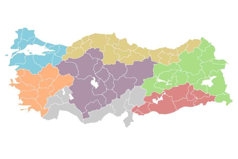
There are seven geographical regions in Turkey, and each region has its own beauty and charm. Located in the inner parts of the country, Central Anatolia covers an area of 151,000 square kilometers. Covering 21% of the country's land, this region is neighbor to all regions except the Southeastern Anatolia Region. The Central Anatolia Region, the second largest region after the Eastern Anatolia Region, is called the country's granary. It has the highest population after Marmara Region.
Since the region is located in the central part of the country and the flat areas take up a large extent, it is easy to reach every region from here. Most of the transportation routes pass through Central Anatolia.
There are 13 provinces and 172 districts in the region. Konya is the largest city in this region, the smallest is Kırıkkale. Konya has the most districts and Niğde has the fewest districts. Aksaray, Ankara, Çankırı, Eskişehir, Karaman, Kayseri, Kırıkkale, Kırşehir, Konya, Nevşehir, Niğde, Sivas and Yozgat are cities in the Central Anatolia region.
The average altitude is around 1000 meters. The landforms are plain. The region mostly consists of plains and plateaus. It leads to easy transportation, large agricultural areas, low agricultural population density, and more regular distribution of the region's population.
Due to the high mountains around it, precipitation is insufficient in Central Anatolia. The region which has continental climate characteristics is mildly harsh in winters.
There are many extinct volcanic mountains in the region. Among them, Mount Erciyes, the most popular, is the country's second-highest mountain. Many tourists go to Erciyes every year for skiing.
The region is surrounded by high mountains, which have led to the formation of closed basins such as Konya, Tuz Gölü, Akşehir, and Eber. Considering the geological structure of the region, earthquake risk is low, especially in Konya.
Climate and Vegetation
Central Anatolia is surrounded by high mountains. For this reason, the continental climate is dominant. Summers are hot and dry, and winters are cold and snowy. Temperatures in the region drop further towards the east. Temperatures average 23 - 24 degrees in summer and between 0 and -3 degrees in winter. The annual temperature difference is high.
Since high mountains surround it, it is the region with the least precipitation. Humidity and precipitation are higher in the northern parts. It receives an average of 300-400 mm of precipitation annually. The most rainfall occurs in the spring, the least in the summer.
Central Anatolia Region generally has steppe vegetation. However, there are also oak forests since rainfall increases in the Central Anatolia Region's higher parts.
Tourism
The important touristic places of the region are fairy chimneys in Ürgüp - Göreme, underground cities in Derinkuyu (Cappadocia), Seljuk artifacts in Konya, Mevlana mausoleum, thermal springs in Eskişehir, Ankara, Niğde and Kayseri, Erciyes and Elmadağ ski facilities in Ankara. Anıtkabir, Atatürk forest farm and Ethnography Museum.